
Combe Martin to Morthoe
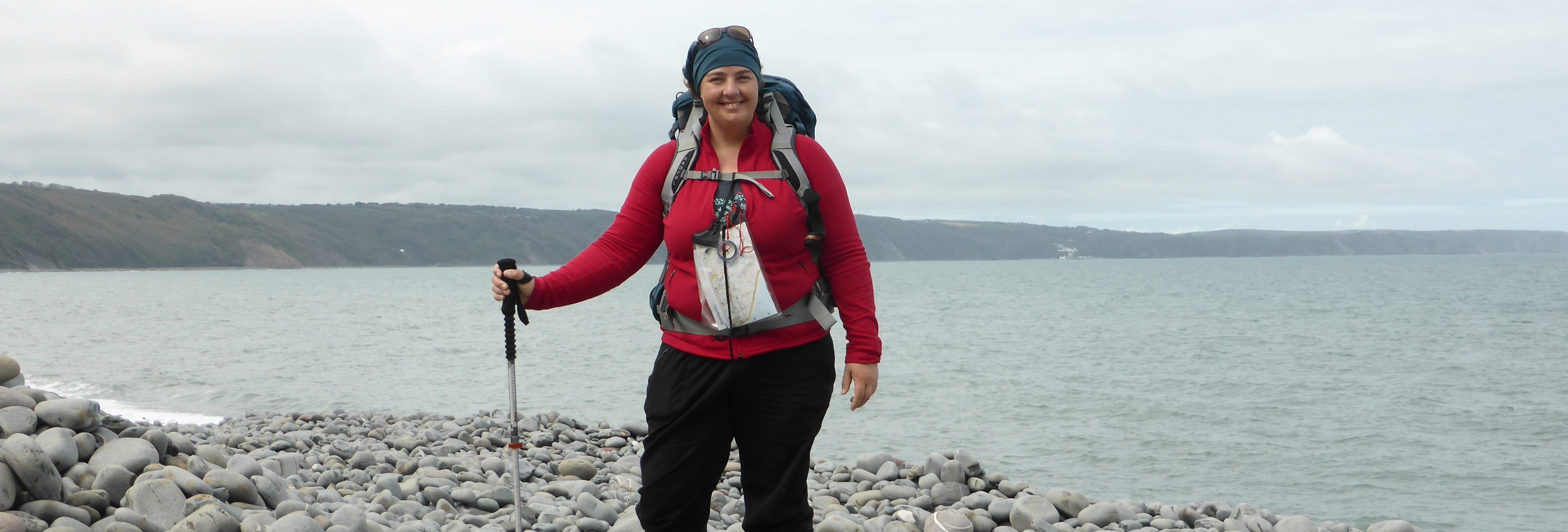
Day four was the last day on the north coast of Devon. From here on out I’d be looking out on the Atlantic Ocean.
Once again I’d organised a luggage transfer, but the LT driver (I think his name was Roy) wasn’t too happy about the big black double-thickness rubbish bag I’d used the day before. I explained that it was a choice made out of desperation, but he had a better plan. He gave me a couple of the plastic ‘hessian’ bags they use for overflow of heavy bags. Happily, everything fit. He went on his way with (almost) all my worldly goods, and I readied myself for another day of adventure.
I said goodbye to the ever-friendly Colin and John, and their Channel Vista Guest House, and returned down the hill to where the path leaves Combe Martin proper, and winds (surprise, surprise) back up, up, up toward the west. The first part of this walk wasn’t terribly nice. It followed suburban lanes and edged main roads, occasionally splitting off around a field or through a small wood. This was the case all the way to Ilfracombe. On the final diversion, just east of town, the path climbs up to an excellent lookout where the long-abandoned Fort Hillsborough used to be. I saw few signs of previous occupation, but it was certainly a fine view of the pier and the first sight of the enormous, striking sculpture of the half-skinned, sword-wielding, pregnant woman by Damien Hirst.
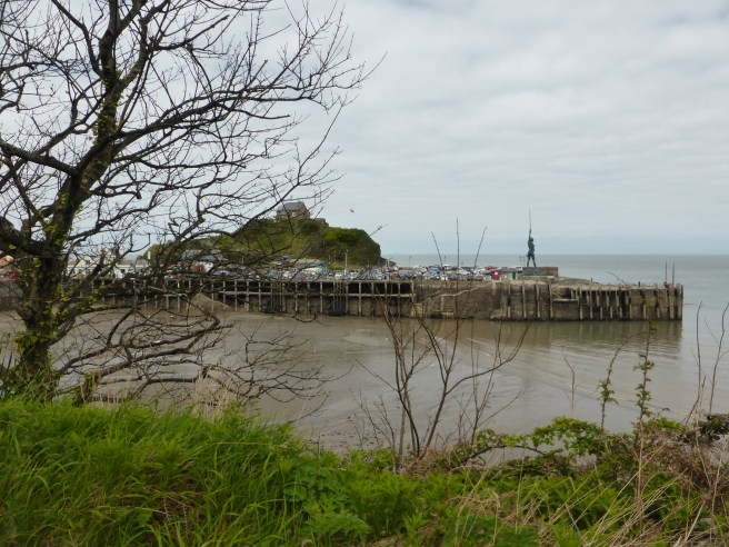
I’d imagine most people find it shocking. I was fascinated. Not just by the thing, but by the decision to put it there. To be a fly on the wall in that council meeting!


Midway through the Easter school break, Ilfracombe was humming. I had a quick stroll around the harbour, but was conscious of time marching on, and the length of the walk ahead, so I got going pretty quickly.
Capstone point, just west of the harbour, was pretty, but a zigzag track annoyingly never seems to progress, and it seemed to take forever to get out of town. Eventually the path straightened out and I was on my way west over farmland marked by modern efforts at ancient skills, such as this dry stone wall.


The area seemed to be popular with day-walkers, so I crossed paths with a lot of folk, but the only people who made an impression were a twenty-something couple i crossed paths with who were convinced there was a bull in the next field. I’m embarrassed to admit, they had me running scared from what turned out to be a cow with cut-off horns. The ‘bull’ followed me at a trot for a good half hour and I’m sure the Beast and i looked like an ungainly teenage mutant ninja turtle as I scooted across the uneven moor, trying not to trip. Every time I stopped and turned around to glare at the ‘bull’ menacingly, just to show it who was boss, it would stop too, then just follow me, closer, and closer, and closer. I kept telling myself nobody would put a bull in a public-access field. But the imagination is a powerful thing. I was very glad to reach the farmer’s gate and shield myself from the poor curious cow who was probably just trying to make friends.
On the positive side, my walk-rate increased for a bit.
By the time I’d wound down the country lanes to the gorgeous little village of Lee…
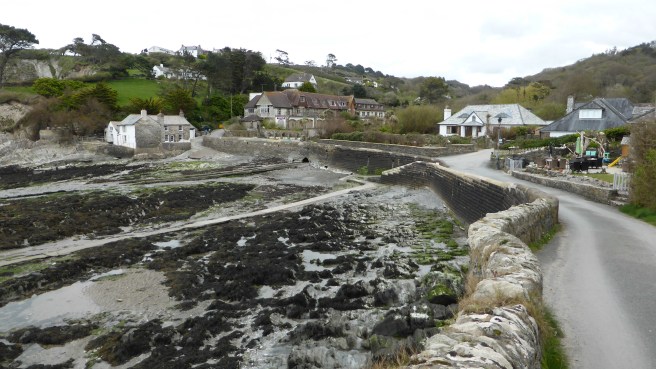
…I was more than ready to stop. Unfortunately, I’d had my stuff transported to a camp ground another five km on and had little choice but to keep going.
If anyone reading this decides to take this path: first, take the bus to Ilfracombe, and second, stay in Lee. It’s a lovely, friendly village with a fabulous rocky bay to explore at low tide.
Knowing if I stopped, I’d have a hard time starting up again, I kept going,…


…climbing up the road through the fabulously-named Damage Cliffs and Wrinkle Wood, to a very raw and lonely section of the swcp. Old, abandoned quarries mar the surface of the up-down-up-down-up-down path around to the light house at Bull Point.
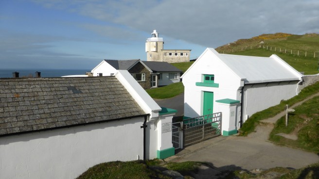
The path looked like it continued in that vein along Rockham Bay and out to Morte Point, but I got off the path at the Bull Point lighthouse and set off along country lanes in search of North Morte Farm where I’d arranged to camp the night.
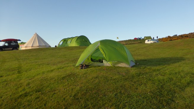
I’d not noted the elevation when I booked the night there. High on a hill, looking to the west over Rockham Bay and out over the Atlantic Ocean, nothing was stopping the blustery wind. After collecting my transported belongings from reception and buying a few necessities (cider and cake) from the camp store, I set off for the camping field to find the perfect spot.
Whoever designs camp grounds should really recognise that tents don’t do well on slopes. This ground was steep, but I found a little level spot near enough to the bathrooms for convenience and took off my boots. Bare feet in the cold grass met two needs. One – stop feet swelling, and two – motivate me to put up the tent super-fast. Check, and check.
Did I mention the camp ground was high on a hill? The view from the front flap of my tent was spectacular. I crawled into my sleeping bag and cracked open the bottle of cider just as the sun set over the horizon.
Gorgeous, I first thought.


But, one hour later that thought had morphed.
Freezing!!!
My inaugural night of camping was far from wonderful.
[Surge stats: 21.89 km, 257 floors, 37291 steps]
